Elephanta (or Gharapuri as known locally), is a small island located off Mumbai’s east coast – broadly situated between JNPT and Mumbai Harbour.
The island is home to cave temples predominantly dedicated to Lord Shiva. The caves have been designated as a UNESCO World Heritage Site.
Apart from the cave temples, the following add to the experience –
-Boat ride from Gateway of India to the Elephanta Island.
The island is approximately an hour’s boat ride from Gateway of India. Ferry’s start at 9 am and continue until about 2 pm. For the return journey, Ferry’s start from the island at 2 pm until about 530 pm. The cost is about Rs. 260 for deluxe and Rs. 125 for an economy ferry – to-and-fro. The ticket counter in the morning deliberately (I think) start with the sale of deluxe tickets! The ferry’s in both cases seemed similar. I guess they cram more people in the economy ferry. All payments in cash. No cards, no UPI!
For me the boat ride to the island is the most interesting bit. Apart from the cool sea breeze, you get a super view of the Gateway and the Taj, naval and commercial ships docked along the Mumbai Harbour, an assortment of commercial ships anchored off the coast, Butcher Island with its oil tanks and its sundry jetty’s, sea gulls, small fish skipping off the waters and a good view of the ever-changing Mumbai skyline. As you approach the islands’ jetty, the new trans-harbour bridge connecting Mumbai and Navi-Mumbai comes into view.
I wish the ferry’s started plying earlier, say 630 am. This would add morning sunrise view to the experience and help complete the to-and-fro outing in the cooler part of the day.
-Climb up to the caves.
There’s a toy train that run’s from the island’s jetty for about a km to the base of the climb up to the caves for about Rs. 10. I think this is best avoided. It’s better to take a leisurely walk and take in the flora fauna of the island.
A Gram panchayat fee needs to be paid at the base, then another fee at the caves entrance. A visit to the loo requires a tip. All of this could have been combined to make it easier for everybody. All payments in cash. No cards, no UPI!
The funds being collected though, may either be inadequate or are not being managed diligently as most of the track is lined with plastic bottles and packets.
Stairs made of solid rock blocks lead up to the caves. It takes about 20 minutes from the base to get up to the caves. The stairs are lined with shops selling eatables, souvenirs and other nick-nacks.
A non-vegetarian joint on the left of the stairs seemed to be the local favourite – judging by the full tables. MTDC seems to have a stay option.
You have to be super careful of the monkeys in the area. They will very easily snatch any eatable in sight and even water bottles!
-Mini trails
A left before the entrance to the caves will take you down to a lake – birders will generally like this route. This would be about a 20 minute walk.
A right before the entrance will take you up to cannon hill – two large cannons placed so as to overlook the east and west of the island. This would be about a 15-20 minute climb.
Chalkewadi about 30 Km from Satara, Maharashtra is a plateau pretty well known for its windmill farm.
The plateau is also home to the 'Fan Throated Lizard'. Apparently the windmills keep their natural predators (broadly raptors) off the area and nooks and crannies of volcanic rocks provide a decent shelter.
May-June is a good time to catch the male of the species with its bright colored dewlap.
The Blackbuck National Park is located at Velavadar in Bhavnagar district in the state of Gujarat and is one of a kind in India.
The park spread over 34 sq km is a mix of grass land, shrub land, saline plain and mud flats and is dedicated to the protection of endangered blackbucks.
Herds of blackbucks can be seen across the flat grassland. As per the guide, there were about 1700 blackbucks in and around the park.
Other wild animals like Indian Fox, Indian Grey Wolf, Striped Hyena, Nilgai (blue bull) also call it home.
The park is a good place to watch grassland birds like larks, bushchats, wheatears, sandgrouse, francolins and quails. The park is also known for its winter roost for harriers.
The park is open from 630 hrs to 1300 hrs and then from 1500 hrs to 1800 hrs. The park stays closed during the monsoon - June to October.
At the park you need to take a permit from the forest office at the gate, hire a guide and take your own vehicle in for the safari. The permit, guide and camera cost us Rs. 1000/- on a weekday and Rs. 1100/- on a weekend. The charges are per entry, so if you were doing the morning and evening safari, you're expected to take two permits.
Fortunately, the park isn't exactly a crowd puller, so things like safari jeeps, restaurants, hotels are absent. As per the guide, the forest dept. also keeps things tight by not allowing any of this.
Stay options are limited to The Blackbuck Lodge just outside the park and the rest house (a dormitory and a couple of cottages) run by the Forest Department. The Blackbuck Lodge is super expensive and the forest rest house is difficult to book.
Off the three nights we wanted bookings for, the rest house was available for one night only. When we checked with the Forest Dept. the previous day of our stay, we were told that our room was given to some other govt. official visiting the site!
So stay was organized at Bhavnagar which is about 50 km from the park - about an hour's drive. Bhavnagar has decent cost effective stay options plus the added advantage of some local sightseeing but the hustle bustle of a city.
Takhteshwar Temple, Bhavnagar
The drive from Mumbai to Bhavnagar is about 630 km and takes about 12 hours. The NH48 up to Baroda is nice, though peppered with heavy vehicles that occupy all three lanes and takes about 7 hours. The Baroda - Anand section is fantastic and takes less than an hour. Anand - Velavadar takes about 3 hours on a patchy highway that is being expanded at places. Heavy traffic and cattle keep things slow on this section. Velavadar - Bhavnagar is an interesting one hour drive on a super two lane tarmac flanked by mud flats. Once inside Bhavnagar, traffic is messy in the narrow lanes.
Taking the RORO ferry from Dahej to Ghogha, Bhavnagar, across the Gulf of Cambay, came up as an option from a experience point of view. Though it meant getting out of Mumbai at 400 hrs to get to Dahej by 1100 hrs. The first ferry leaves Dahej at 1200 hrs and you need to report an hour earlier.
Since we weren't sure of our schedule, we hadn't booked the ferry ride in advance. Unfortunately, the ferry was running full that day and we had to settle for VVIP fee of Rs. 3,000/- (against a regular fare of about Rs. 1,700/-) for the two of us and the vehicle.
The ferry started half an hour late that day and took two hours to cross the murky brown waters of the Gulf of Cambay. The embarkation and disembarkation of cars, trucks and buses was handled pretty decently by the ferry crew.
On board, i think two hours is just about the time you can spend walking up and down the vessel, gazing at the horizon, catching a munch at the canteen and snoozing, before it starts getting boring.
Ghogha to Bhavnagr is a 45 minute drive on a patchy narrow two lane with a lot of two wheeler traffic.
Early next day, we got good sightings of blackbucks, nilgai, fox, wolf and hyena at the park.
The guide - Ramzan Khan was good and took us around the park and made sure that we were lined up properly with the light and gaps between the dry foliage from a photography perspective. Though for me it meant handing the camera with a long lens at the ready and taking quick tight turns at the wheel. The Thar's ground clearance and grunt helped.
In Bhavnagar, food at Rangoli and the gujrati thali at Rasoi was very nice. We also sampled some local food - fafda, khandvei and jalebi at the market.
Day two at the park was also decent. Saw a crested serpent eagle while heading to the park in the morning. Another visitor mentioned sighting a pack of four wolves near where the eagle was spotted.
From a photography perspective day two was better. I guess I was better prepared after reviewing the day one pictures and I think the light was better.
Post the safari on day two, we pushed off to Anand to reduce drive distance to Mumbai the next day.
Visited the Amul factory at Anand. Enjoyed the food at Amul Foodland just outside the factory and picked up a load of chocolates from the Amul store.
On the way back to Mumbai, stopped at Legend Hotel at Baroda for a Gujrati breakfast and chai and Hotel Ahura at Talasari for some Parsi Chicken Dhansak for lunch.
Uran, next to the bustling JNPT port, has a pretty vast
wetland area that is home to quite a few spices of birds - both resident and
winter visitors.
I was super lucky to witness the India Skimmer on a quite
morning - flying lightly, in a loop, just above the surface of the water and skimming the water with its longer lower mandible for food!
Unfortunately, with all kinds of development activity around - Airport and SEZ, the area may lose its birding fauna in the near future!
Reached Akshi Beach at about 730 hrs after a rock and
roll drive via the NH17 which is under repairs. The twisty section around Poynad
was a good drive though.
Early in the morning with the tide near its high point,
the beach looked pretty unassuming. As the sun came up a little more, flocks of
winter visitors could be seen settling down.
Oyster Catcher
Lying down flat on the beach and crawling up slowly
helped me get close to some of the visitors.
Kentish Plover
Shooter in the open!
There’s a small parking area with some shacks retailing
snacks. There's also a loo and a changing room – not
exactly hygienic though.
Tadoba Andhari Tiger Reserve (TATR), about 150 km south
east of Nagpur towards Chandrapur, had been on my radar for some time now.
Safari bookings are a tricky affair and multiple safaris
increase chance of a ‘sighting’ therefore joined up with a group. Another
advantage of the group was the interaction with the group leader - a seasoned
wild life conservationist and sharing of the day’s experience with the rest of
the group.
Landed at Nagpur in the month of May when it’s really hot
and dusty. The road from Nagpur to Moharli was decent and took about three and
half hours.
We got lucky in the first safari in the afternoon with a
chance meeting with Bajrang and Matkasur both well-built young male tigers.
While Bajrang snoozed peacefully on the banks of the
Andhari River under a canopy of trees, us tourists sweated it out in the open
gypsies about 100 mtrs away. Any movement by Bajrang was met by a barrage of
camera clicks! Finally around 5-530 pm, snooze over, Bajrang walked away into
the thick dry vegetation.
Matkasur was out watching over and marking his territory.
The sight of 10-20 gypsies with overzealous tourists didn’t seem to bother him.
Well-built fellow, almost as long as the gypsy, every step he took oozed tons
of grandeur.
The two safaris the next day didn’t yield any sightings.
Apparently Choti Tara at Jamini Talao and her two cubs kept to the thicket
while we were around.
The next day morning we chanced on Choti Tara lazing just
outside a thicket near Jamni Talao. We missed Maya by a couple of minutes at
another water hole.
While the focus tends to be on tiger sightings the
reserve is teeming with a lot other animals and birds and is a super place to
catch up with nature.
Oriental Honey Buzzard
Brown Fish Owl
Monitor Lizard
Green Bee-eater leaving its nest
Gaur
Langur
You may want to:
Dress in dull coloured clothes and cover yourself
as much.
Be prepared to handle dust – glares, cap and a
scarf / hiking headband help.
Carry a bottle of water (and perhaps an ORS like
Enerzal) when out in the sun.
Late Aug ’16 work finally allowed me some time off for the drive to Ladakh.
I had been planning this for the past few years and I guess I couldn’t be better prepared for the drive. The Thar was serviced and ready to go. The hard top made the Thar more livable for a long drive through diverse terrain and weather conditions. All sorts of winter clothing was in place. The itinerary was thoroughly researched and planned.
Disturbance in the Valley meant a last minute change in the route. I’d have to plan the entry and exit to Ladakh via Manali. Wasn’t very comfortable with the change, as it meant traversing the Manali – Leh NH 21 which was at a higher altitude and the road condition was way tougher as compared to the Srinagar – Leh NH 1D.
However, the situation in the valley didn’t leave me with much of a choice.
Captains Log; Star Date 2608.2016
Day 1 was the familiar 800 km stretch of Mumbai-Udaipur. Rains added a certain challenge, but the smooth roads of NH8 and Hallol-Moddsa SH5 allowed me to maintain a decent average and get to Udaipur in about 13.5 hours.
Golden Gate Bridge, Ankleshwar
Captains Log; Star Date 2708.2016
For the Udaipur-Delhi run, I stuck to the NH8 this time. The Rajasmand-Ajmer tarmac turned out to be great though I had to watch out for cattle squatting in the middle of the two lane section!
Captains Log; Star Date 2908.2016
An early 5am start from Delhi helped me get to Ambala by 830 hrs. Made my way through Kharar, Kiratpur Sahib, Bilaspur, Sundernagar, Mandi and Kullu. Progress slowed down post Kiratpur Sahib once the hill section started. The drive between Mandi and Manali along the Beas River was super. Lunch at a local dhaba at Sundernagar was great with rice, shepu vadi and ma-ki-dal. Covered the 600 km run from Delhi to Manali in 14.5 hrs.
Spent the next two days in Manali taking in the local sights – Hadimba devi temple, Solang and the Manali market and checking out some local trout fish at Gozy Resturant. Light rain had brought down temperatures and I could see fresh snowfall on the high hilltops.
Driving to and fro between my hotel in the Log Huts area and the Manali market was tricky as it meant maneuvering through narrow roads with an occasional oncoming vehicle. Finding a parking place in Manali was an issue.
Arranged my permit for crossing Rohtang for Leh from the SDMs office at Manali. The permit required submission of an application available at the photocopy shop in front of the SDM Office, a copy of my driving licence, vehicle registration and PUC. The permit was issued across the counter in a jiffy.
Captains Log; Star Date 0109.2016
As per plan, the 500 km run to Leh, was split in to two days with a break at Jispa – 150 km from Manali, past Rohtang and Keylong. Opted for Jispa over Sarchu as Jispa is at a lower height at about 11,000 ft, while Sarchu is at about 14,000 ft. and Sarchu only has tents. Given wet weather conditions in the past few days I wasn’t sure of spending the night in a tent.
Started at 615 am from Manali. Cleared the registration process at Gulaba and stopped for a much needed gobi paratha and chai at Marhi.
As I started getting closer to Rohtang which is at a height of 13,058 ft, I started getting a slight headache due to the lower oxygen level. Some good deep breaths helped. I kept the body hydrated by regularly sipping water and an electrolyte (Enerzal).
The hydration rule helped the body acclimatize without any issues through my stay in Ladakh.
The road up to Rohtang is in good shape. There are some narrow stretches and oncoming traffic needs to be watched. As I started early there was hardly any traffic.
Post the pass, the tarmac disappeared! Because of the rains in the region, the track was all slushy. Low GC vehicles were struggling to get through the slush.
The Thar was at home in the slush. At places I could feel the rear wheels slip and spin. The Thar’s GC, short wheel base, rear wheel drive and broad tires propelled the vehicle without much of a struggle in 2WD mode.
The track remained slushy up to Kokshar, where vehicles have to stop at the Police barrier for registration.
Shooting stones short of Tandi left a mark on the Thar – a dent on the bonnet!
Filled up at the Indian Oil pump at Tandi. The next pump is 365 km away at Karu.
The winding roads beyond Tandi, along Keylong up to Jispa were a pleasure to drive on. Reached Jispa by 1200 hrs. Found Hotel Ibex to be pretty comfortable. The food was decent. Spent some time by the Bhag river in the evening.
Captains Log; Star Date 0209.2016
Started early at 530 hrs for the long 350 km run to Leh. It had rained at night and I thought that would make the roads up ahead tricky.
Registered at the police barrier at Darcha. Post Darcha vegetation disappeared and rocks took over completely. The road got rough and pretty narrow at a few stretches.
Drove past Zing-Zing Bar and started the climb to Baralacha-La (16,000 ft). As I climbed, I could see snow around me. Baralacha-La was completely covered in snow. Fortunately the tarmac was great. It was cold and the altitude was getting to me so pushed on to descend quickly.
Baralacha La
Down at Killing Sarai, the tarmac disappeared. Found some uneven tarmac around Sarchu. Registered at both the HP and J&K Police barriers at Sarchu. Had a much need bread-omelet and chai and pushed off.
It got pretty warm in the afternoon but I was sort of lost in the terrain – most of it brown hills and a river, with a green tinge, cutting through the hills.
Gata Loops
Hit the Gata Loops – a series of quick 21 loops that take you up about 2,000 ft to NakeeLa which is at about 15,500 ft. Thereafter you descend down to Wisky Nallah. The road again climbs up to Lachug La which is at a height of 16,600 ft.
Stopped at Pang (15,000 ft) at a small shack, run by a Tibetan lady, for a quick dal-roti lunch. Soon after Pang the tarmac showed up at the More Plains which is at a height of about 15,000 ft.
Kangla Jal Bridge, short of Pang
The road through the More Plains is straight out of a movie. Super tarmac, straight and more or less flat with hills in the far peripheries. This stretch sort of takes away the tiredness of the Jispa-Pang stretch.
The whole stretch, about 170 km, from More Plains, past Debring, Tanglang La (second highest motorable pass in the World - 17,582 ft), Rumste, Upshi, Karu and up to Leh is super Tarmac.
Reached Leh at about 1930 hours. The room at Panorma Hotel on the Yourtung Road, though cheap, was disappointing, but I took it for the night. I just wanted to sleep!
Next day first thing in the morning moved next door to Leh-Chen. The room was good. The parking was great. The food was just about ok.
Sankar Monastery, Leh
Clouds were beginning to break, to reveal a blue sky.
Captains Log; Star Date 0409.2016
Started at 700 hrs for Nubra.
The plan was to drive up to Turtuk (after checking for availability of diesel at Diskit) and spending the night somewhere there. The drive was going to take me through the world’s highest motorable pass – Khardung La at 18,038 ft.
So you start at about 11,000 ft at Leh, climb up to 18,000 ft at Khardung La and then go down to about 10,000 ft at Nubra.
Relied on the GPS to get to the Leh-Khardungla road. The road up to and a little beyond South Pullu was in super condition. After some time the tarmac gave way to a rough track – mud and stone. That coupled with the incline, curves and on coming vehicles really tested the vehicle and driving skills.
As I climbed up I could see snow around the pass.
Reached the pass at 830 hrs and felt super great to have finally got to Khardung La!
The pass was buzzing with people lining up to take a picture with the board proclaiming ‘Highest Motorable Pass’.
Parked on the left and got out for a quick shot of the pass. It was windy and chilly outside the vehicle. I didn’t want to hang around for long given the altitude even though I was doing just fine.
The drive down to North Pullu was equally rough. The cinnamon tea and momos at the Ladakh Scouts canteen, on the left of the Police Barrier, was super.
Slowly after North Pullu, the tarmac started to improve. The drive from Khardung village to Nubra was great. The valley comes up suddenly after a turn and I slowed down to take in the Nubra river cutting through the rocky mountains on either side.
Covered the distance of 117 km from Leh to Diskit in about 5.5 hrs and reached Diskit at around 1230 hrs. Still had another 100 odd kms to do for Turtuk, so pushed on.
The pump at Diskit had fuel and the guy there assured me that he’ll have fuel the next day too.
The road from Diskit took me past the sand dunes at Hundar and small villages along the Nubra River. The road is narrow but pretty well metaled and it crisscrosses the Nubra River over a couple of suspension bridges around Skuru and Bogdang. The logs on the bridges make hell of noise over the gush of the river water.
About 1300 hrs I was feeling hungry and stopped about 5 kms short of Thoise and dug into the packed breakfast.
Half way through breakfast, I briefly heard an engine noise echo in the valley. Didn’t take me long to identify the noise to a helicopter but because of the echo in the valley I was finding it difficult to tell the direction. As the noise grew louder I spotted two MI17s turn through a gap in the valley, flying low along the other side of the valley, over the river and losing height to land at Thoise. Super sight.
Captains Log; Star Date 0509.2016
Got back to Diskit by lunch and checked into Hotel Sten Del. I think this is the best hotel around in Diskit. Neat rooms, nice garden and amazing food.
Spent the rest of the day at the Maitreya Buddha and Gompa at Diskit.
Captains Log; Star Date 0609.2016
Started for Leh at 830 hrs after a sumptuous allo-paratha breakfast.
While climbing up Khardung La I was relying on the Thar’s crawlability. As a habit I tend to keep the clutch use minimal and the Thar’s crawlability helps. But I guess due to the lower oxygen here, the engine stalled while negotiating a climbing turn with vehicles coming down not leaving me with much room.
With just about half a meter of track between me and a 1000 foot drop, panic kicked in. Quickly engaged the 4x4 high, turned on the engine and eased up on the clutch and then the handbrake – again going back to using the crawlability. The vehicle reluctantly but slowly got me out of the situation.
Lesson learnt – one use the clutch a little to ramp up the RPM so that the turbo kicks in and two make sure that the vehicle is in the turbo range before you get into a tricky situation.
Reached Leh at 1400 hrs and checked into Oriental Hotel at the beginning of the Yurthung Road, just below the Shanti Stupa. The hotel, run by a Tibetan family, turned out to be super. Excellent rooms, super garden and very good food (really liked the Ladakhi Breakfast). Parking though was a slight issue with the area being able to fit in only two vehicles.
The total run from Leh to Turtuk and back was about 450 Km. The 20 ltr fuel top up at Diskit helped.
Captains Log; Star Date 0709.2016
Visited the Hall of Fame and tried some Tibetan cuisine at the Summer Harvest Restaurant, Fort Road.
Tukhpa – a nice big bowl of noodle-soup with chunks of vegetables and boiled chicken pieces is a complete meal for a solo traveler. From thereon it was only Thukpa whenever I was eating out at Leh.
Captains Log; Star Date 0809.2016
After lazing around Leh the previous day, today's plan was to head to Pangong Tso - a 160 km drive via Chang La - third highest motorable road in the world at 17,688 ft.
Started at about 730 hrs from Leh. Tanked up at the Indian Oil pump at Karu.
The road (again unpaved!) around Chang La isn’t as tough as Khardhung La, but the incline on either side is steeper. The road around Zigrail before Chang La and around Tsotalk and beyond after Chang La is super.
Registered at the Tangste Police Barrier at about 1130 hrs.
The tarmac from Tangste to Pangong Tso is super and a pleasure to drive on. It’s a narrow road that twists and turns through the countryside.
As soon as the blue water of Pangong Tso catches the eye, the tarmac disappears! So the focus is back on negotiating the rough narrow track.
It’s an amazing sight – a patch of blue amidst various shades of brown. Parked alongside the lake at about 1300 hrs.
This part apparently called the ‘Three Idiots Point” was pretty crowded with a host of eating joints, tourist vehicles and tourists animating different selfie positions! There was even an enterprising fellow with a yellow scooter – “Kareena’s Scooter” – doing brisk business at 50 bucks a picture!
So moved on and drove past Spangmik to a quiet place and parked alongside the blue waters.
Around 1600 hours the wind picked up and the waters turned rough. I had to pull on my fleece jacket to keep warm.
I had fixed up my stay at Tangste instead of the tents here. So as the sun started to set, got back on the road and headed to Tangste.
As the sun dipped behind the mountains the sky was still a dark shade of blue, but the valley was dark. Driving with headlights on the narrow twisty tarmac was super fun.
Dothguling guest house at Tangste is a family run show. The rooms are comfortable. Hot water is an issue. Simple Indian food is served in the Tibetan style dining hall.
Captains Log; Star Date 0909.2016
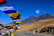
Picked up some prayer flags from Dothguling’s store, had breakfast and moved for Leh at about 745 hrs.
Reached Karu at about 1130 hrs and turned left for the Hemis Monastery.
Captains Log; Star Date 1009.2016
With the Kargil War Memorial on my mind, started for Kargil at 730 hrs.
Stopped briefly to check out the Indus-Zanskar confluence and the Magnetic Hill.
The tarmac beyond Nimoo was just amazing – even the edges had yellow paint!
Stopped at Fotu La (13,479 ft – highest point on the Srinagar-Leh route) and Namik La (12,198 ft) for some customary pictures and at an Army run café at Kalste for maggi and chai.
Fotula Top
Fueled up at Kargil at about 1400 hrs after the 229 km run. The Kargil War Memorial was still about 60 km further up towards Drass so moved after a quick lunch. The road up to the Memorial was plain amazing.
A soldier there narrated the entire Kargil war scenario. The entire crowd (including some young soldiers from another unit) stood in rapt attention and were moved by the bravery of the Army.
Tololing
Came back to Hotel D-Zozila at Kargil for the night halt. Decent location – the new block is on the bank of River Suru. Food was ok. Room was neat.
Captains Log; Star Date 1109.2016
Given the super road conditions this side, the thought of going back from the Srinagar side kept playing on my mind. But whoever I interacted with, be it other tourists, hotel staff or shop-keepers at Kargil, all of them told me to exit Ladakh via Manali.
So headed back to Leh. Spent some time at the Lamayuru Monastery, the Gurdwara Pathar Sahib and the Zanskar-Indus confluence enroute. Super enjoyed the kheer and jalebi at the langar.
The next day was spent lazing around Leh, window shopping and stocking up provisions for the return.
Picked some cookies and Yak Cheese from the Pumpernickel German Bakery. The chocolate cinnamon roll was just super.
Captains Log; Star Date 1309.2016
Got up early, packed and moved at 530 hrs. The plan was to take advantage of the super roads around Tanglang La, Debring & More Plains and cover the route up to Pang fast.
The fuel pump at Karu was closed at 600 hrs.! Fortunately I had topped up at Leh the previous day. But the additional 7-8 ltrs would have meant an additional range of 80 odd kms.
The chill, wet roads and fresh snow above got me worried as I started the ascend to Tanglang La. Somewhere short of the pass, I had small crystals of snow going splat on the windshield!
As soon as I got to the other side of the pass, I was happy to see the clouds breaking up and the sun starting to peek.
Stopped at Debring for a quick maggi and chai at a Tibitean run shack. Had a nice chant with the person there on the upcoming visit of the Dalai Lama.
Enjoyed the expanse of the More Plains and the drive on some decent tarmac.
Maintained as steady a pace as I could through Pang and Sarchu. The bridge at Killing Sarai was under repair, so the BRO guys asked me to go through the fast running stream!
Baralacha La didn’t have any snow but down at Zing-zing Bar there was still a stream flowing on the road.
Got to Jispa at 1720 hrs and checked into Padma Lodge. Decent place right by the Bhag River.
Captains Log; Star Date 1409.2016
Started at 730 hrs. with the fuel indicator leaning towards the red mark.
Fueled up at Tandi and moved on to Rohtang. Things were slushy but not as bad as on my way in.
Reached Manali by 1330 hrs and thought of stretching it till Mandi but I think the heat (and a heavy lunch) got the better of me and by Bhuntar I was done for the day.
Over the next few days drove back to Mumbai with the drive through Ladakh still running in the head.
Some points that help:
Start early.
Keep enough drinking water in the vehicle – I used to have at least 3 boxes at any given point.
Fuel up at the end of the day – helps if you have an early start the next day.
Dress in layers. Mornings and evenings are chilly but the rest of the day can get pretty warm. Though I carried a heavy jacket as well, a wind-sheeter and a fleece pullover worked for me.